
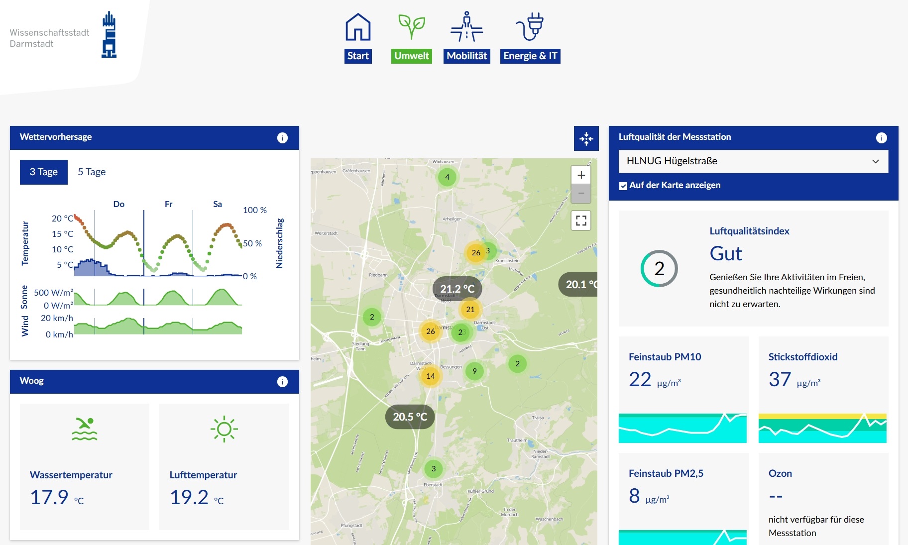
The data platform of the Science City of Darmstadt has a new look and functionality. It is now aligned with the new design of the city’s website and is even more user-friendly. The homepage offers access to three areas: Environment, Mobility, and Energy & IT. On the respective subpages, charts and diagrams clearly present the data – additionally, they can be viewed in a map view. The data platform of the Science City of Darmstadt can be accessed via the link datenplattform.darmstadt.de.
Mayor Hanno Benz and City Councilor Holger Klötzner commented: “The new data platform of the Science City of Darmstadt offers users even more customized options for data presentation, and the map function underscores its clarity. The platform was redesigned due to technical requirements and, despite its expanded functionality, can contribute to budget consolidation. The data platform was developed in collaboration with Digitalstadt Darmstadt GmbH, the municipal company for municipal tasks and services of the Science City of Darmstadt, and COUNT+CARE GmbH & Co. KG, and is continuously being developed further.”
Examples of the new features include information on weather and air quality, pollen count, and waste on the environment page. This data is now fed from various measuring stations in Darmstadt. This allows citizens to select specific locations depending on which district they want to see.
The display of glass container locations (with and without fill levels) marked on the Darmstadt map is practical for everyday use. The map also shows where, in addition to glass, electronic waste or old clothing can be disposed of.
The city map now also has several new mobility features: In addition to the standard street view, you can switch to a bicycle map with all bike paths and a public transport map with all bus and tram lines and stops. You can also find information about construction sites, the work being carried out there, and its duration.
Energy & IT displays the electricity supply from renewable energies in a diagram. Municipal photovoltaic systems are now also recorded and displayed here. The map view also illustrates the coverage of the free “Darmstadt WiFi,” which can be used by anyone. This also displays additional locations in the individual districts.